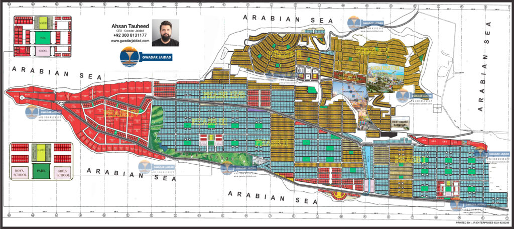
Sangar Housing Scheme Map provides important insights of project’s development criteria and location view as per Gwadar Master Plan 2019. Being a government project under supervision of DC of Gwadar, Sangar Housing is a safe scheme in Gwadar Master Plan 2019 and its map is here.
Sangar Housing Scheme map shows that the project is located at the top of Koh e Batil which is also known as Hammerhead. This rock spans over an area of 13 Kilometers surrounded by water from three sides while one side is connected with land.
This amazing location feature is enough to define the beauty of Sanghar Gwadar and its future residents will be living on the most mesmerizing site of Gwadar. The given map of Sangar housing scheme comprises of 5 Phases are given as under:
Phase VPhase 1, 2 and 3 are a mix of residential and commercial while Phase four comprises commercial plots only. As you may see the map of Sangar Housing Gwadar also hints about some salient features in the area i.e. Prime Minister’s House, Parks, proposed land for Eid Mela, Rest House Sangar and Pearl Continental which is a functional five star hotel.
Amazing location, site beauty, functional PC Hotel, and development status all recommend Sanghar Housing Scheme Gwadar the safest and best investment venue in Gwadar with best returns in short period of time.
Would you like to share your creativity with the world? Submit your video by clicking on the button below.

CEO – Gwadar Jaidad
Call / Whatsapp +923008131177
Social Chat is free, download and try it now here!